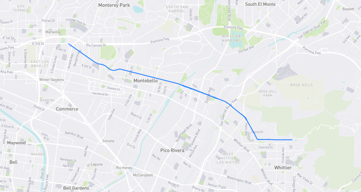
Why is there a six-mile gap between this Beverly Boulevard and the Beverly Boulevard that runs between DTLA and Beverly Hills? Were they ever meant to connect? The answer is yes. Why they didn’t is harder to explain. Here’s what I could glean: In the era before freeways, the idea of Beverly Boulevard being a single thoroughfare from Whittier to the Pacific Ocean was hatched in 1923. (“West” Beverly Blvd. was already mostly completed by then; it was indeed extended all the way to the coast in 1926, but that westernmost portion became part of Sunset Blvd. eight years later. The entire planned course was reportedly 67 miles long; by my measurement it was more like 40 miles.) The name, of course, was borrowed from trendy Beverly Hills and thus held a lot of allure for business owners along the street. The plan was to have Beverly extend through the 2nd Street tunnel in DTLA, across the Los Angeles River via 4th Street, and then – I think – traverse Boyle Heights via 3rd and/or 4th Street, continuing through East L.A. and Montebello, and terminating in Whittier. Montebello acted quickly, changing its Dewey Avenue to Beverly Blvd. in 1924, while Whittier finally changed its Turnbull Drive to Beverly Blvd. in 1928-1929. So what happened to the rest of the route? Although there was still talk of completion as late as 1931, plans obviously fizzled out. Thing is, this wasn’t just a simple matter of changing street names to “Beverly”: numerous connecting segments had to be built, many of them on privately-owned land, and it seems too many landowners would not sell their property for the boulevard’s right-of-way. That, plus the pinch of the Great Depression, is what probably killed the 67-mile dream.
Find it on the map: