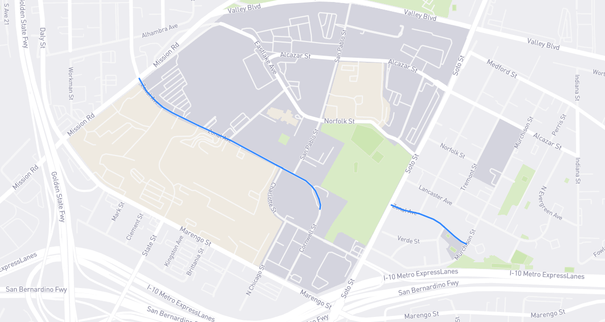
This street’s etymology is hazy; my best guess is that “zonal” refers to the eastern boundary – the “end zone”, if you will – of the City of Los Angeles. (Maps show how the 36° angle of streets laid out in L.A.’s original four square leagues ends just east of here. For more on that weird angle, see 1st Street.) It’s worth noting that Zonal Avenue was originally laid out in 1888 a little east of its current location – and along the edge of city limits. It was a crescent-shaped road that ran from Soto to Wabash on A.E. Pomeroy‘s De Soto Heights tract, long since bisected by the 10 freeway. The lower half of that crescent became part of Evergreen Avenue by 1921. Meanwhile, the portion of Zonal that now abuts USC Medical Center was originally known as Wood Avenue! It became part of Griffin Avenue in 1897, then part of Zonal over a decade later. The reasons behind these changes are lost in the mists of time.
Find it on the map: