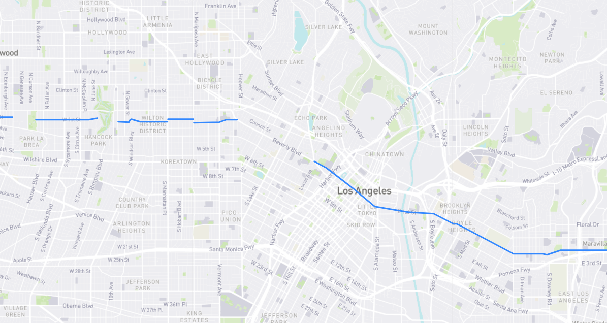
First things first. The ordinal numbering system of L.A.’s streets was established by 1846. Years later, in 1883, addresses south of 1st Street – technically southwest, since DTLA’s grid is laid out at a 36° angle – were given the postal designation “South”, while all addresses north of 1st were “North”. That’s why we have, for example, 789 N. La Brea and 789 S. La Brea. Likewise, addresses east of Main Street were designated “East” and so on. Now, about that 36° angle: this supposedly harkens back to the Laws of the Indies, written in 1573 to guide the construction of Spanish colonies worldwide. Historians claim that colony streets were to be laid out at a 45° angle (so that all structures may receive equal sunlight throughout the day), but since the geography of young Los Angeles didn’t quite allow for that, the pueblo’s founders got as close as they could with 36°. I’m skeptical about all of this. I couldn’t find that 45° rule in 18th century books of those laws, L.A.’s first streets weren’t exactly rigidly planned, and after California’s 1850 statehood, there was no need for L.A.’s streets to follow the old Spanish code. And yet they adhered to that 36° angle until 1896, when the city finally expanded west of its original four Spanish leagues and new streets shifted to a north-south orientation. You can see the angle change at Hoover Street if you look at a map.
Find it on the map: